Crossing Canada – Part 2
The Drive
If you are just jumping in, you might want to read the first part of this post, found here
With the Alberta sightseeing out of the way, we hit the road to Ontario. I had been warned that the drive would be nothing more than 4 days of mind numbing monotony. It turned out to be 6 days.
But little of it was mind numbing, on the contrary, I found it very interesting. The fact that we timed it with the height of the Autumn colors might have had something to do with it….
Click on picture for larger view….
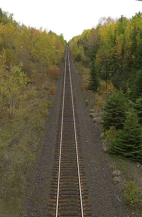
Image Copyright 2005 Tim Warris
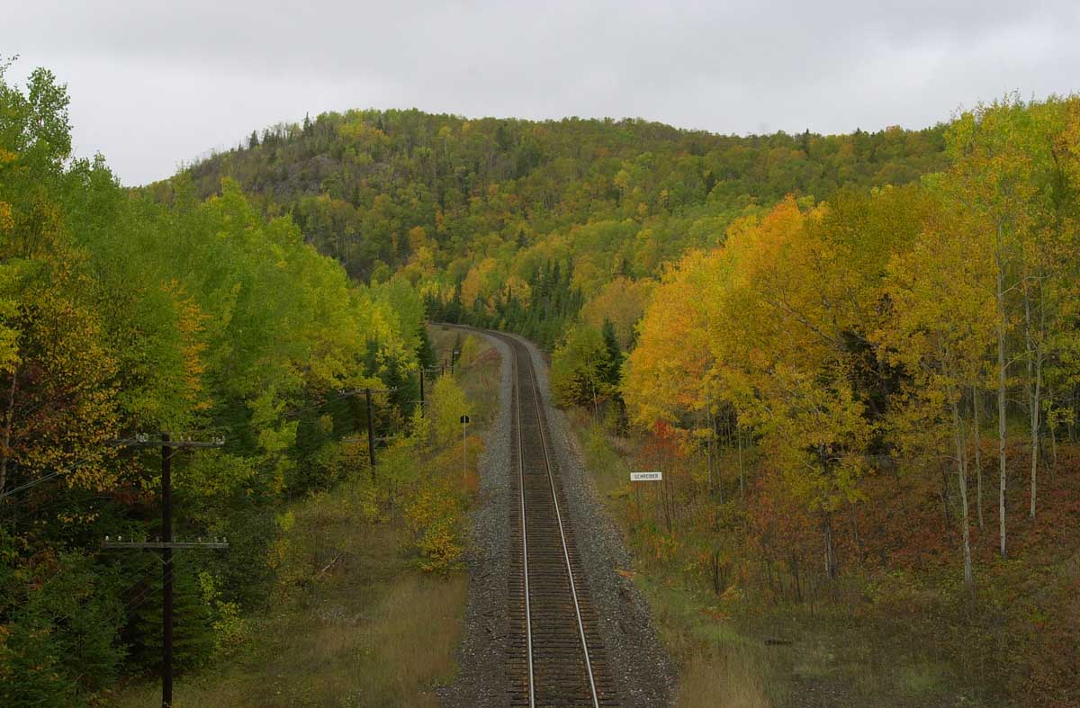
Train tracks somewhere between Thunder Bay and Sault Ste. Marie, Ontario.
Of course, nothing comes without a price. The weather on the drive was interesting. We got it all, everything from bright sunny warm days to a blizzard.
When we left Calgary around noon on Tuesday in the rain.
Image copyright 2005 Tim Warris
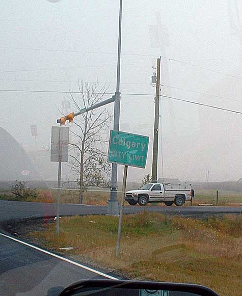
Every journey starts with a single clich�
3200km in a Jeep.
Image copyright 2005 Tim Warris
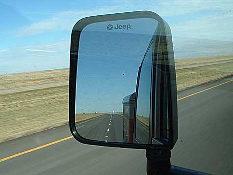
I guess there was some looking back….
After the first 2 hours we were already bored. We decided to make a short side trip into Brooks, Alberta to check out the remains of the “Brooks Aqueduct”
Image copyright 2005 Tim Warris
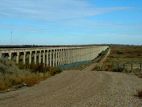
This stood in the middle of the Alberta Prairies
This massive erection was built in 1914 by the CPR to transport water to the dry farms, I assume to increase traffic on the railroad. It still stands today, although barely. The entire structure is accessible, so we crawled around it a bit and took some pictures.
Image copyright 2005 Tim Warris
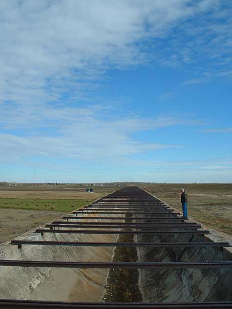
Standing on the top of the aqueduct, looking into the 3km long concrete spillway
It was abandoned in 1979 when a new canal was constructed beside it.
Image copyright 2005 Tim Warris
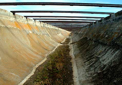
Sure would be fun on a motorbike in here….
After an hour snooping around here we were back on the road. We made it as far as Medicine Hat the first day, and decided to pull off the road early.
Hitting the road early the next day, we headed into Saskatchewan, and the Canadian Prairies. The stereotype image of Saskatchewan is that it is all flat, and while this was true for some areas, it was not as flat as I was led to believe. Next to northern Ontario, I found Saskatchewan had the most interesting scenery.
For the Canadians out there who are familiar with Corner Gas, a throughly Canadian TV show, we stopped in Rouleau, Saskatchewan, the location of the fictitious town of “Dog River”.
Image copyright 2005 Tim Warris
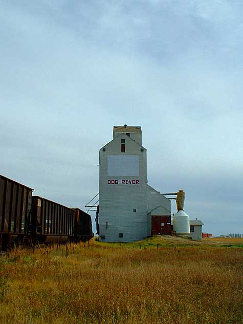
Rouleau was painted over with Dog River
This turned out to be one of the more interesting stops along the way. The whole building is a set, and looked out of place in the little town. In town it was easy to spot the buildings that are used for the show, as they have Dog River written on them. I am sure it was one of the biggest things to happen to this sleepy little town in the middle of Nowhere, Saskatchewan.
Image copyright 2005 Tim Warris
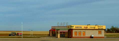
The trusty Jeep waiting in front of “Corner Gas”. We had to get gas elsewhere.
Back on the (dirt) road out side of Rouleau (a.k.a. Doug River) on the way to Regina, Saskatchewan, we found a complete abandoned farm. This place was right out of the 40’s, and it appeared the residents just up and left. We spent a bit of time here exploring the place, and it was ripe with photographic opportunities. A few days could be spent here taking pictures. Ron and I had lots of fun.
Image copyright 2005 Tim Warris
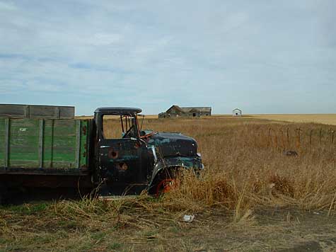
No shortage of rusty things here.
Image copyright 2005 Tim Warris
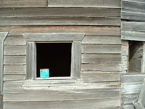
Image copyright 2005 Tim Warris

State of the art TV’s!
After taking a few hundred pictures here, we headed into Regina for dinner and once again headed east on the Trans-Canada highway. Our goal for the day was Brandon, Manitoba.
The last hour or so of the drive was a white knuckle experience! The temperature had dropped and the snow started. By the time we got close to Brandon, the highway was covered with ice and we were sliding all over the place. Somehow, in spite of the 18 wheelers blowing past us, we managed to get into town and to the hotel we had reserved online the day before.
Unpacking the Jeep was a frigid experience, with the wind blowing COLD off of the praries….
Image copyright 2005 Tim Warris
Not what one from Southern Ontario expects to see in the first week of October!!
We woke up the next morning to a bit of a shocking sight. Snow! Lots of it too. We overheard the local truckers at the greasy spoon restaurant we had breakfast in talking of 2 feet of snow between Brandon and Winnipeg. We soon found out they were not kidding….
Image copyright 2005 Tim Warris
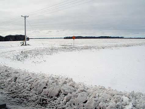
This was making us a bit nervous.
We hit the road early with hopes of getting 600-700km behind us for the day, but soon changed our minds. We drove for 2 hours through the snow and decided to wait out the weather in Winnipeg and try again the next day. We did not want to risk being blown off the road in the middle of Trees, Northern Ontario.
The stop over in Winnipeg was nice, and turned out to be the nicest hotel of the trip. We both unloaded our computers and took full advantage of the Wifi connections in the room to get quite a few hours of work done.
We got started early, and headed for Thunder Bay, Ontario, about 750km away.
Apparently there is little of interest between Winnipeg and Thunder Bay, as I could not find a single picture on the camera…
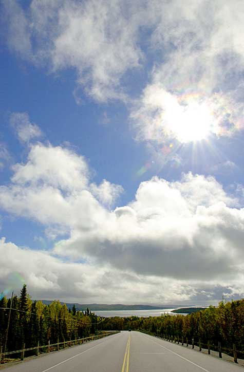
However, the drive from Thunder Bay to Sault Ste. Marie was fantastic! The weather cleared up and the snow disappeared.
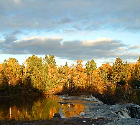
Image copyright 2005 Tim Warris
Pictures can not do this place justice,
The most dramatic scenery played itself out for us for the next 10 hours of driving. We stopped lots of times to take some pictures of amazing scenes of northern Ontario.
Image copyright 2005 Tim Warris
The leaves were co-operating nicely
Click on picture for larger view….
Image Copyright 2005 Tim Warris
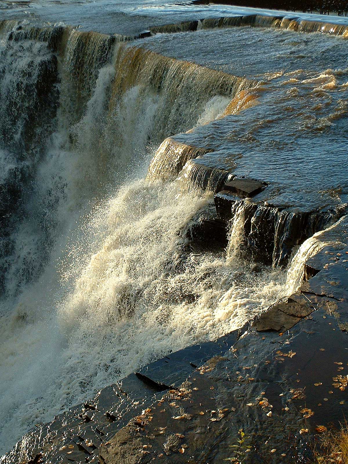
kakabeka Falls.
Image copyright 2005 Tim Warris
Just outside of Thunder Bay, Ontario
After spending the night in Sault Ste. Marie at a crappy hotel, we had to haul tail to the ferry dock on Manitoulin Island, back to Tobermory, Ontario. From there, 3 hours later we pulled into the driveway and the journey was complete. Now, with 50 hours on the road behind us, it is back to work.
Well worth the effort it took, but I am glad I only had to do it one way….
Posted by: | 10-10-2005 | 09:10 PM
Posted in: Uncategorized
Tim,
Outstanding ! Canada just has to be seen from ground level , either by train or car , or perhaps jeep and trailer ! Your journey though at least three Canadian seasons was inspiring to say the least ! The excellent pictures were well worth sharing and are excellent inspirations for some of our layouts , from fall colours in Northrn Ontario , to water and falls , to the wonderful prairies !
The commentary was excellent , and I ‘enjoyed’ the trip !
But one complaint , it is over too soon !
Thankyou , Ian
There is nothing like driving around your own country to really get a feel for its size, you’ve got abig one, we have a big one, pity the poms in england 🙂
By the way, good trip.
Steve
Great pictures, wish there would have been many more! Traveled mid and sothern routes across the USA, but not ever a northern one, course my travels was about 40 years ago.
As well as a good modeler your pictures are excellent. You have a steady hand and a good eye foe the sceane. Another way to see our Canada, and other spots, is with Ron Garnett’s “Air Scapes” screen savers. There is another one who hase the eye for the “perfect picture”. Yor web site has taken up my whole morning, it has be so interesting. Thanks. John